
YOUR SAFETY IS IMPORTANT TO US
We want you to be prepared when traveling our roads.
We do our best to provide timely updates regarding our work, so you can have current information when traveling our roads and for planning your trips.
Help the community stay updated by sharing your tips on our social media pages.
We do our best to provide timely updates regarding our work, so you can have current information when traveling our roads and for planning your trips.
Help the community stay updated by sharing your tips on our social media pages.
DISCLAIMER
Road conditions may change quickly, and the information on this site might not be completely accurate or timely. Please drive with caution and consult other sources of road and weather information when planning your trip. Western Forest Products will have no liability whatsoever regarding the content on this site or any damage that might be caused by relying upon that content.
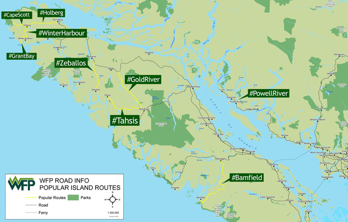
AREA MAPS
These maps are geo-referenced and can be used with Avenza to show your location even when cell service is unavailable.
NORTH ISLAND
Central Island
Connect and stay informed on social mediaThis is a community site. Let us know if you see anything out of the ordinary on your trip.
If it's safe to do so, take a photo or video of the current condition. Share a few words and use our handle @WFPRoadInfo and a location hashtag. eg. Use #PowellRiver in your social post.
|

